

What lies beneath the Domus dei Gladiatori? A multi-method survey at Pompeii
By Tigo Sanchez, CMO · with Simona Miccolis (GPR survey) and Davide Murano (3D models and video)
GGM.EARTH surveyed the Domus dei Gladiatori (House of the Gladiators) in the Pompeii Archaeological Park as preparatory work for the XVII International Training Summer School — Archaeology, Caves & Hypogea, held from 20 May (Naples) to 31 July 2026 (Timișoara). This is what we measured, why we used several methods on the same walls, and what the data can and cannot say.
What did GGM.EARTH do at Pompeii?
Short answer. We surveyed the surface of the Domus dei Gladiatori with UAV photogrammetry and a handheld SLAM scanner, then investigated the subsurface with two ground penetrating radar systems: a MALÅ MIRA Compact multichannel array and an IDS Chaser. GNSS tied everything to the same coordinates. The aim was one integrated model of surface and shallow subsurface.
The survey was preparatory work for the XVII International Training Summer School — Archaeology, Caves & Hypogea, organised by COIFA in Bari and the "King Mihai I" University of Life Sciences in Timișoara, Romania. The school turns real archaeological sites into working laboratories for surveying, documentation and interpretation. The 2026 edition ran from 20 May to 31 July, starting in Naples and concluding in Timișoara.
For us the site mattered, and so did the people around it: universities, surveyors, researchers and young professionals from different countries, working on the same ground.
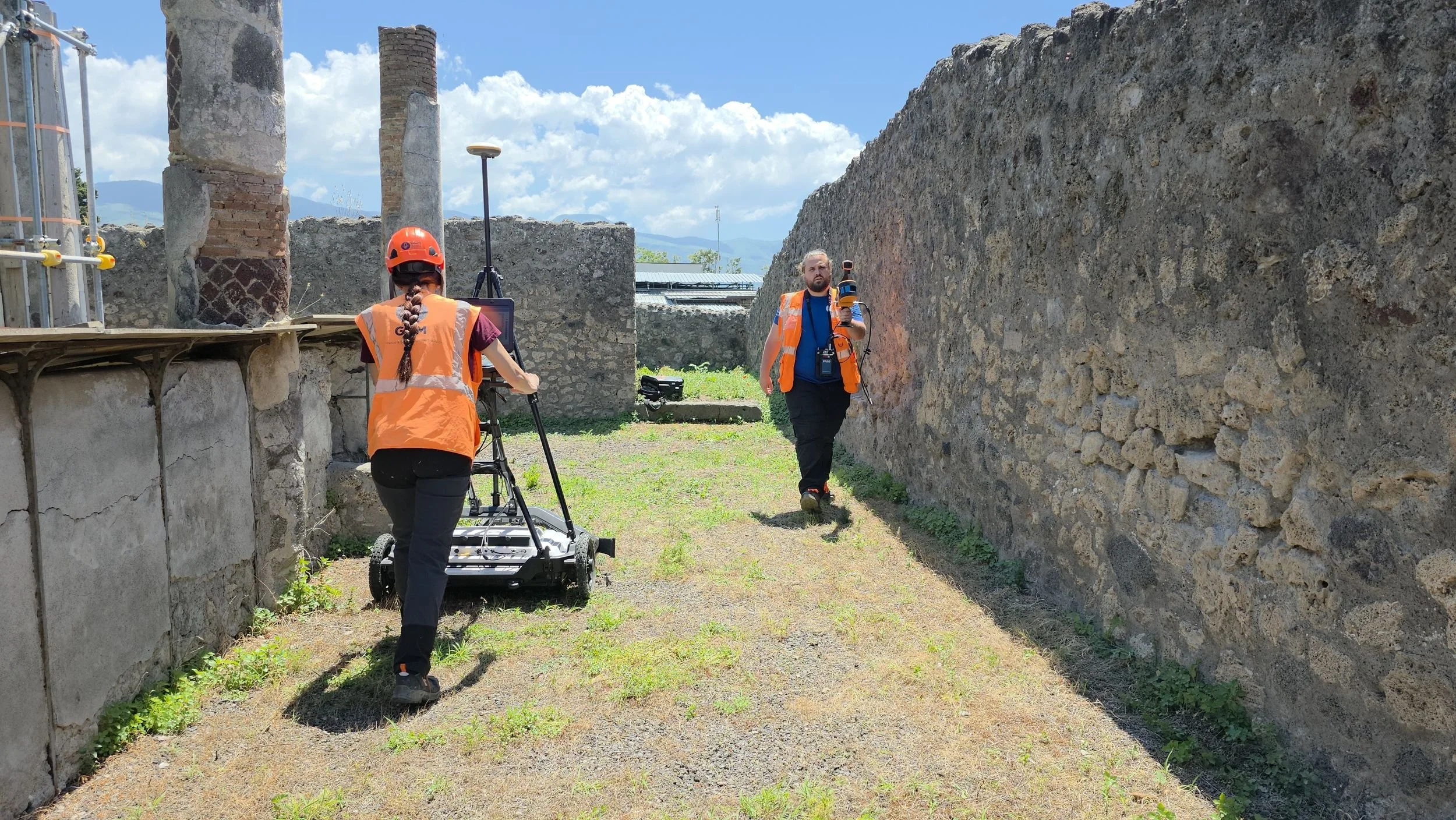
Why use several instruments on the same walls?
Short answer. Because each instrument answers a different question, and none of them is conclusive alone. Photogrammetry and SLAM record what still stands, the radar reads contrasts below the ground. Registered in the same space, they confirm or contradict each other, and that is where interpretation becomes reliable.
Each piece of the kit had a precise job:
Handheld SLAM scanner. Follows corridors and thresholds where a tripod cannot go, filling the spaces a static scan misses.
UAV photogrammetry. Gives the wider picture: the house inside its block, its streets and neighbours.
MALÅ MIRA Compact and IDS Chaser GPR. Send electromagnetic pulses into the ground and record what comes back. A buried wall, a void and a filled cut each return a different contrast.
GNSS. Ties every dataset to the same coordinates.
The kit on site also included a FARO laser scanner and a FLIR thermal camera: the first records standing structures at millimetre scale, the second reads surface temperature, where moisture and detachment often show before the eye can see them.
On its own, every dataset is an opinion. A radar anomaly lying exactly beneath a change in the masonry is a different thing from a radar anomaly on its own. This is the logic of our Multilevel Survey System: independent methods that validate each other before anyone decides where to dig.
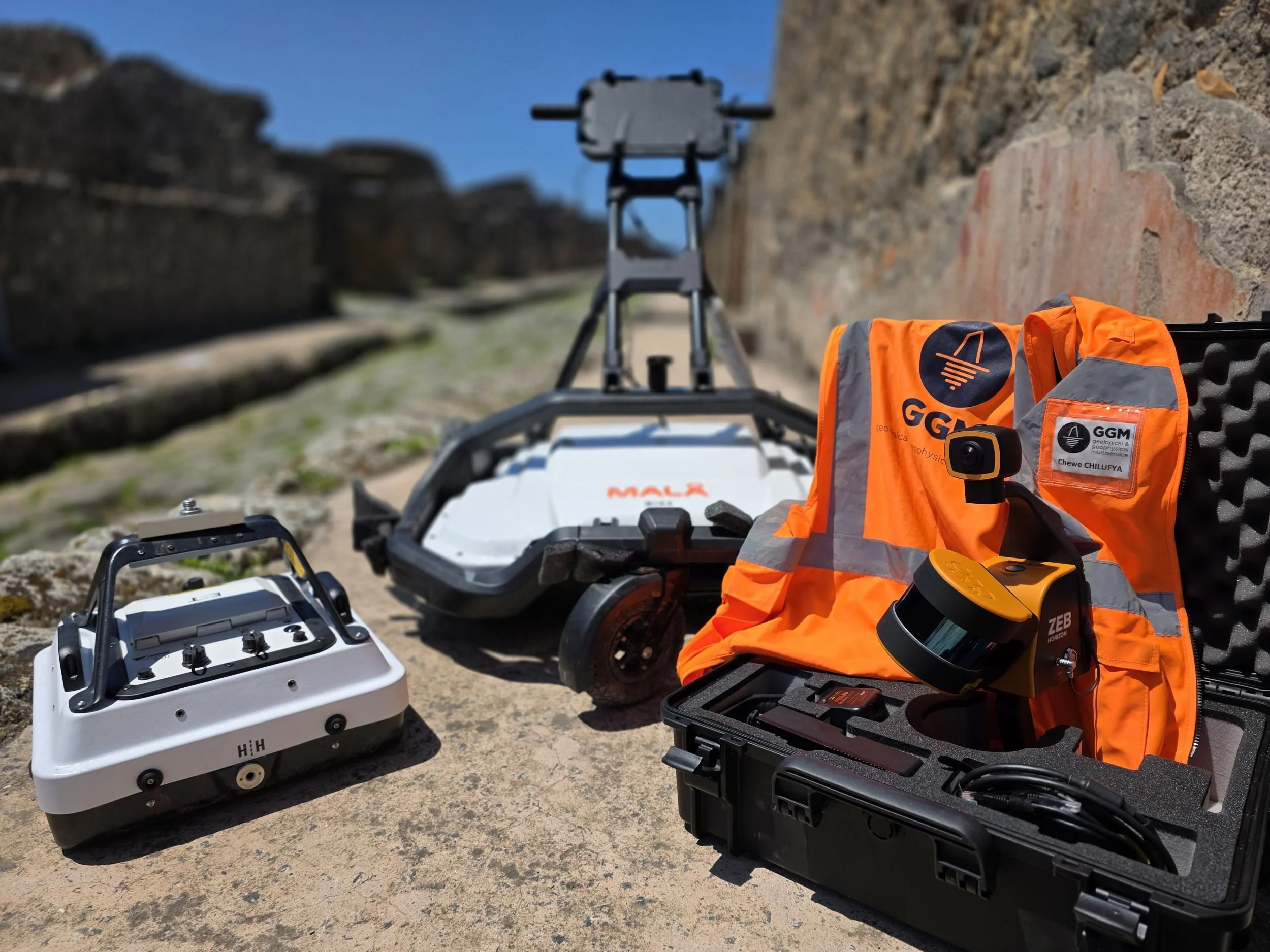
How does ground penetrating radar see below an archaeological site?
Short answer. GPR sends short electromagnetic pulses into the ground and records the reflections produced wherever the electrical properties of the subsurface change. Walls, voids, fills and floors return different contrasts. Processed into amplitude maps, horizontal time slices and 3D volumes, those reflections become spatial information that can be interpreted.
At the Domus, Simona Miccolis operated the MIRA array while GNSS positioning kept every line spatially controlled. Field acquisition is only the first step of the chain: survey, processing, interpretation, 3D model. In between, the operator reads the site, watches the acquisition and makes decisions in real time. On a site open to visitors, that includes moving a multichannel array through narrow passages and around people without losing coverage.
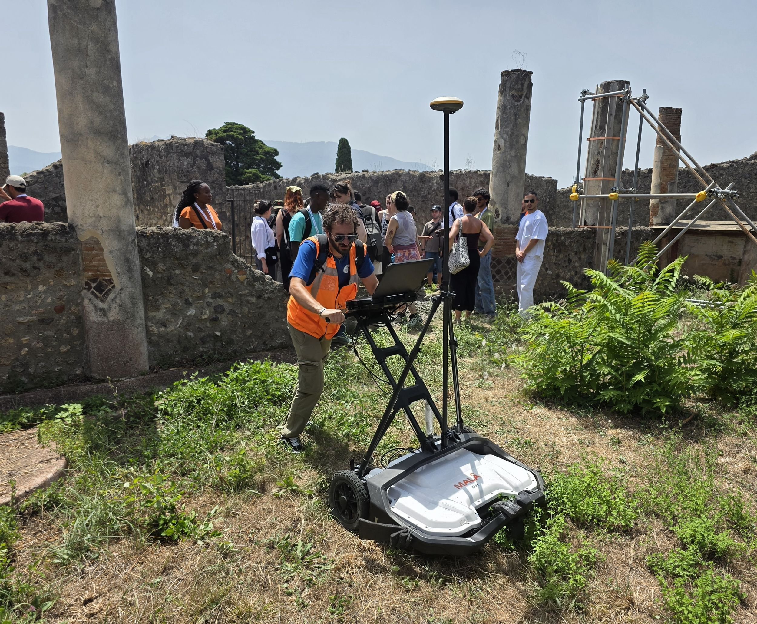
Why two radars on the same site?
Short answer. Frequency is a trade-off. Higher frequencies resolve finer detail but lose depth quickly; lower frequencies reach further with less detail. A multichannel array like the MIRA covers the ground in dense parallel lines and builds a 3D volume. A single antenna can go back over a specific target at another frequency.
Using both lets us check a feature at two scales before calling it one. The array gives the continuous picture of an area; the single-antenna system is the second opinion on the points that matter.
What did the survey find?
Short answer. In the GPR time slices one area stands out: an anomaly that we associate with an underground cistern. It is an interpretation, not an excavation result. It becomes useful because it sits inside a model where the surface above it is measured and every dataset shares the same coordinates.
The most readable view is the sequence of horizontal slices, scrolled from shallow to deep, where the anomaly is highlighted. In a single radargram it would be a pattern; in a stack of slices registered to the photogrammetry and SLAM models it becomes a located, measurable feature that archaeologists can compare with what they already know about the house.
What we do not claim: the exact depth, dimensions or date of the feature. Those belong to the archaeological interpretation, and to a verification that only the people responsible for the site can decide.
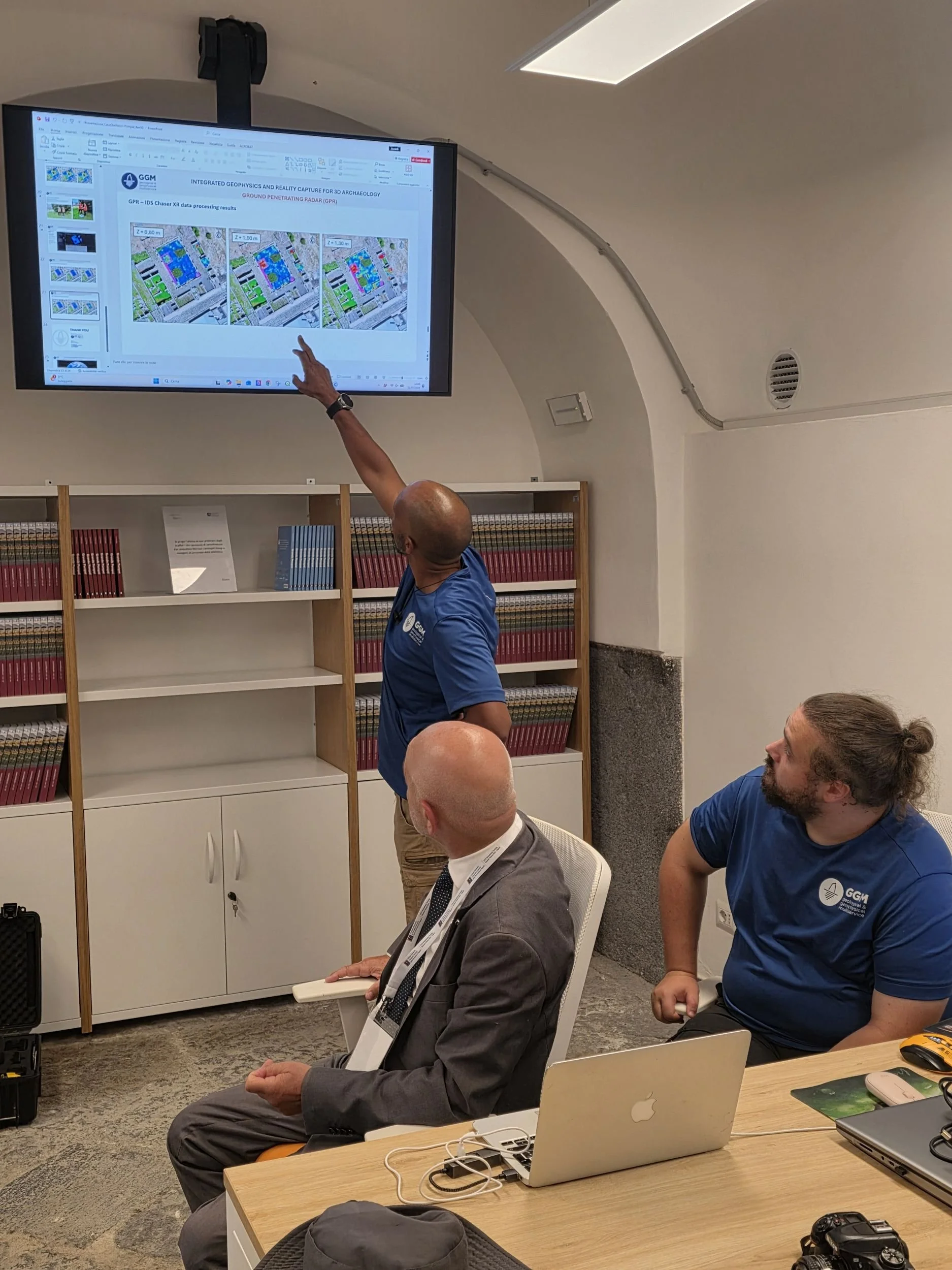
Who was on site?
Chewe Chilufya, Co-CEO of GGM.EARTH. Simona Miccolis, who operated the MIRA array. Davide Murano, who turns what we collect into 3D models and video. And Pietro Grimaldi, Cultore of Architectural Photogrammetry at Politecnico di Bari and Associate Professor of Photogrammetry at UȘAMV Timișoara, who built and leads the school. We thank him, the participating universities, the faculty and the students of the XVII edition.
What does this mean for heritage sites?
Short answer. It means knowing more before the first trowel goes in. An integrated survey tells archaeologists and site managers where the subsurface changes, how those changes relate to the standing structures, and which anomalies deserve attention. It does not replace excavation; it helps decide where excavation, or protection, is worth it.
For GGM.EARTH, cultural heritage means bringing geoscience into places where every measurement must be precise, spatially controlled and useful to the people interpreting the site. Pompeii is a world reference for exactly that. We have done this before: with 3D GPR under an ancient church in Rome, where a known crypt calibrated the depth of unknown ones, and with five methods at Pietrarsa.
The next chapter may be further south. With GGM Surveyors, our Southern Africa Division in Zambia, we are working towards bringing this kind of training experience to Southern Africa.
FAQ
Is a GPR anomaly a discovery?
No. An anomaly is a contrast in the data. It becomes an interpretation when other datasets, the site's history and the archaeologists' knowledge support it, and a discovery only when it is verified.
Does a geophysical survey damage the site?
No. GPR, SLAM, photogrammetry and GNSS are non-invasive. Nothing is dug or drilled.
What is a GPR time slice?
A horizontal map of radar reflections at a given depth range, built from many parallel lines. A stack of slices shows how a feature changes with depth.
What is the MALÅ MIRA?
A multichannel GPR array that acquires many closely spaced lines in one pass, producing dense data for 3D volumes.
Why tie everything to GNSS?
So every dataset shares the same coordinates. Without that, comparing a radar anomaly with the masonry above it would be guesswork.
Who organises the Summer School, and when was it held?
COIFA, based in Bari, and the "King Mihai I" University of Life Sciences in Timișoara, Romania. The 2026 edition ran from 20 May (Naples) to 31 July (Timișoara).
Related: Mapping the invisible: subsurface survey in an ancient church of Rome · Project insights: Pietrarsa, Naples · Our methodology
Video: Pompeii, Domus dei Gladiatori: UAV photogrammetry, SLAM and 3D GPR survey on YouTube
Summer School: coifa.it · usab-tm.ro/en
GPR survey work at the Pompeii Archaeological Park was conducted as part of the XVII International Training Summer School — Archaeology, Caves & Hypogea (https://lnkd.in/epSCpMXz), organized by COIFA (http://coifa.it/), based in Bari, and the “King Mihai I” University of Life Sciences in Timisoara, Romania (https://www.usab-tm.ro/en).